While 105 Hikes In and Around Southwestern British Columbia is the product of careful research, it’s rare for any book to go to print without error. Between editions, trails and roads are prone to changes to boot.
Accordingly, I encourage you to post trail and access updates in the comment section — and contact me with suggested corrections. Please share current conditions, such as snow levels and wildlife closures, in the 105 Hikes Challenge group on Facebook.
Note: The following list of errata and addenda is by no means complete. I cannot guarantee the accuracy or currency of this information. You assume full responsibility for your safety and health in the backcountry. (See the Safety Notice on page 5 of the book.)
Hike 7: Lower Mount Fromme
- New trail restriction: The Kirkford trail is now reportedly “mountain biking only,” which throws a wrench in the described loop. (I haven’t confirmed this.)
Hike 11: Capilano Pacific Trail
- Partial trail closure: The Capilano Pacific Trail is closed indefinitely in the Moyne Drive area due to landslides, as of January 2021. According to the District of West Vancouver, “The recommended detour is to use Moyne Drive to Rabbit Lane to Stevens Drive to Hadden Drive to Mathers Avenue to 3rd Street to the new path along the Upper Levels Highway to Keith Road.” See the detour map.
Hike 19: Tunnel Bluff
- Access change: Due to new parking restrictions at the Tunnel Point rest area, access is now from Sunset Drive in Lions Bay — the same trailhead as Hikes 17 and 18.
Hike 22: Stawamus Chief Mountain
- Transit service change: Parkbus no longer stops at the Stawamus Chief parking lot. Disembark at Shannon Falls instead.
Hike 32: Brew Lake
- Vehicle access change: All vehicles must park before the bridge, which is condemned as of September 2018. 4WD vehicles can no longer drive a bit farther.
Hike 33: Brandywine Mountain
- Vehicle access correction: From Callaghan Valley Road, turn left (not right) on Brandywine Creek Forest Service Road.
Hike 35: Crater Rim Trail
- Transit service change: Whistler Transit Bus 20 (Cheakamus) to Cheakamus River Road at Highway 99.
Hike 36: Half Note Trail
Hike 37: Flute Summit
Hike 38: Blackcomb Burn
Hike 39: Decker Tarn
- Transit service changes: Whistler Transit Bus 5, 6, 7, 8, 20, 21, 30, or 32, or Pemberton Valley Transit Bus 99 (Pemberton Commuter) to Gondola Exchange.
Hike 41: Skywalk South
- Transit service change: Whistler Transit Bus 30 (Emerald via Alpine) to Drifter Way at Alpine Way.
Hike 42: Skywalk North
- Transit service change: Whistler Transit Bus 30 (Emerald via Alpine) to Mountain View Drive at Valley Drive.
Hike 48: Joffre Lakes
- Map correction: The north arrow should point to the right (not up).
- Park rule change: Dogs are banned.
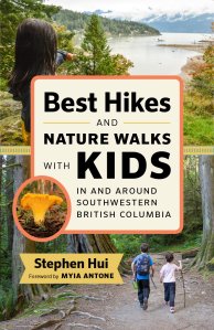
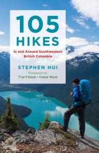
New books